Marymoor Park Model Airfield
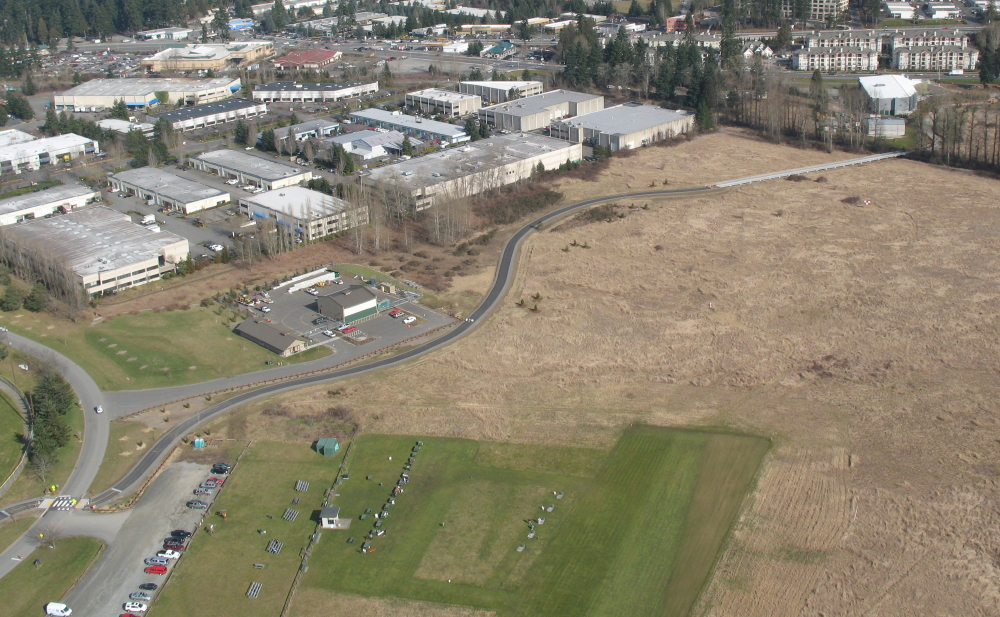
The model airfield is located in the northeast corner of Marymoor Park. It is an officially approved FRIA (FAA Recognized Identification Area). As a FAA FRIA, model aircraft are not required to have remote ID modules installed in the aircraft when flown within our boundaries and operated following the club and AMA safety protocols..
The field has a 120' x 380' grass runway and a usable airspace of approximately 600' x 1800'. A large grass area containing picnic tables and bleachers is provided for spectators. The airfield is managed and maintained by the Marymoor R/C Club through an agreement with the King County Parks Division.
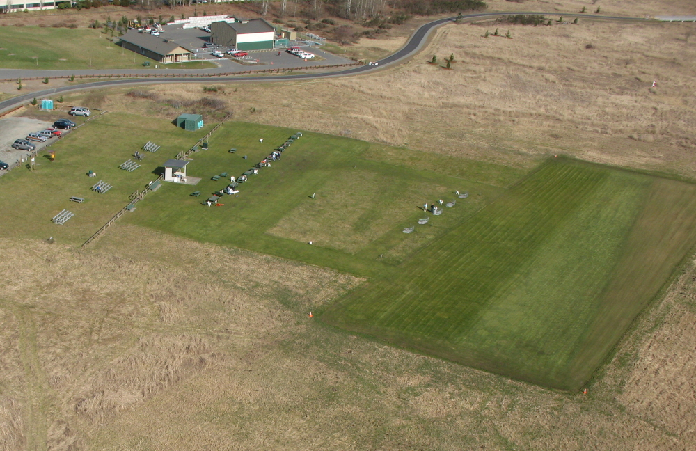
Click here to see a high resolution photo of our flying area. The image is 58217 x 25157. You are able to zoom in and see fine detail. It was windy when the images were collected, so some of the areas are a little blurry. The image is made up of 822 photos captured by a drone autonomously flying and recording images, that were then stitched together into one image. Click here to see the airfield on Google Earth.
Airfield Flying Area
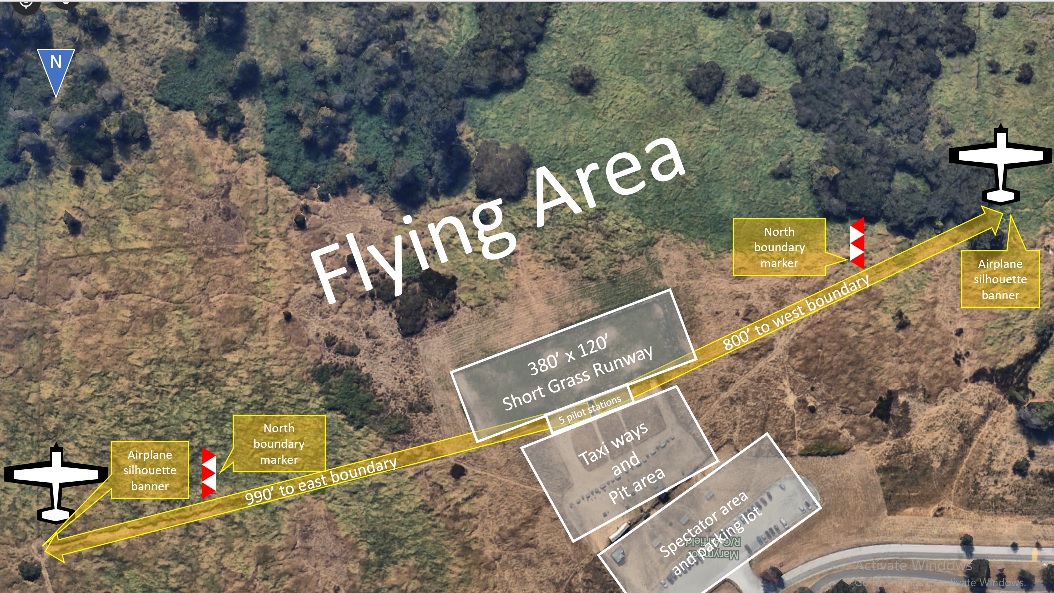
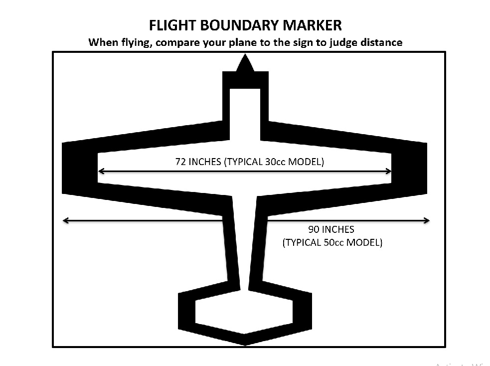
The Marymoor Flying Field (Airfield) diagram below shows the Runway, Flying Area and boundary markers to help orient pilots during flight. The image is shown looking south, which is the view that a pilot will have from the pilot stations along the northerly edge of the runway. To the left and right, pilots will see a sign displaying red and white triangles. These two signs define the safety line which is the northerly edge of the permitted Flying Area. All flying must take place in front of (south of) this line (per AMA Safety Code). To the far left and right, pilots will see large banners displaying a black and white airplane silhouette. These identify the east and west ends of the Flying Area and assist with judging distance (see scale diagram below, posted at each pilot station).
Airfield Rules
To assure the safe and orderly operation of the Airfield, It is important that all flyers understand and comply with the Airfield Operating Rules, and the AMA Safety Code. Everyone inside the fence shall comply with the general Safety Rules. Park rules apply to everyone. See Rules tab.
Airfield Use Schedule
In accordance with our Special Use Agreement with King County, MAR/C members have exclusive use of the Airfield on all days. Join the club and fly with us.
Parking
The Marymoor RC airfield has a dedicated parking lot, which require a parking pass. They can be purchased for $1 (cash only) at the airfield or online. Visit our parking page for more information.
Marymoor Park Weather Station
MAR/C maintains a weather station that provides current conditions at our field.
The club's cameras provide a view of the field (facing south) and the parking lot (facing north).